Log in
All resources
Create a design
33,250 Free Images of Astronomical Maps
maps made in the 18th century
atlantis magni tomus primus (biblioteca comunale di trento)
pieter schenk (i)
18th-century engravings
old maps of europe
war of the spanish succession
cities in europe
new york city
george hayward
images from the new york public library
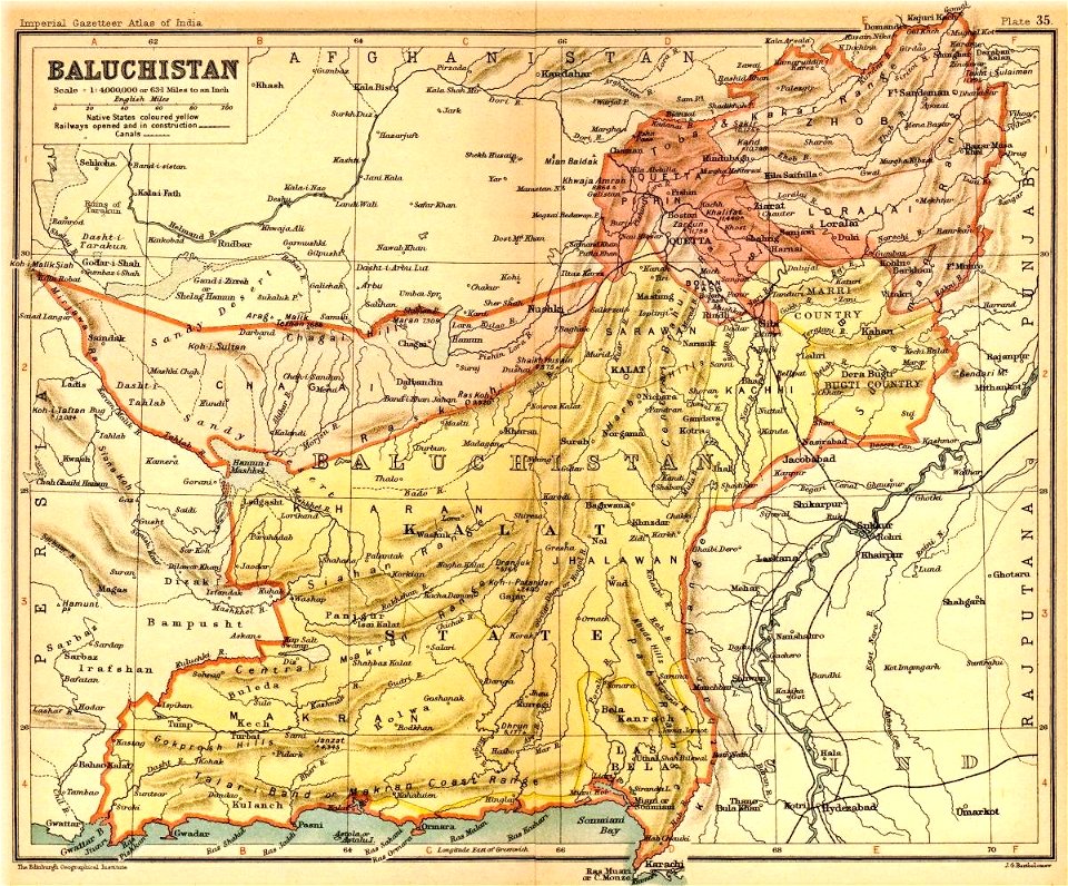
the imperial gazetteer of india (new edition 1909)
1907 maps of india
maps in the national library of australia
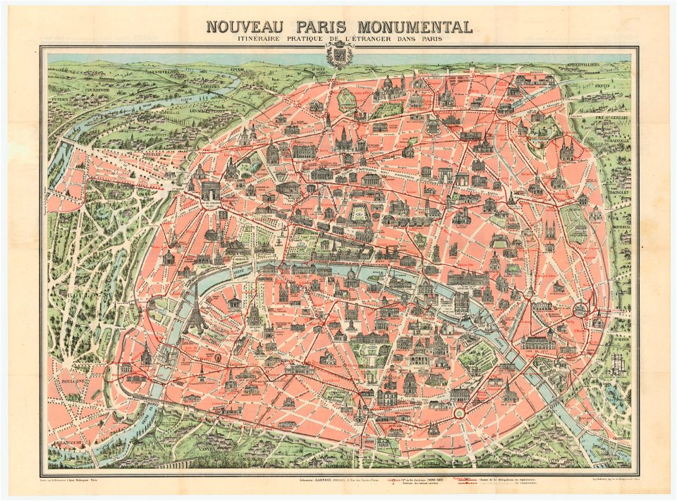
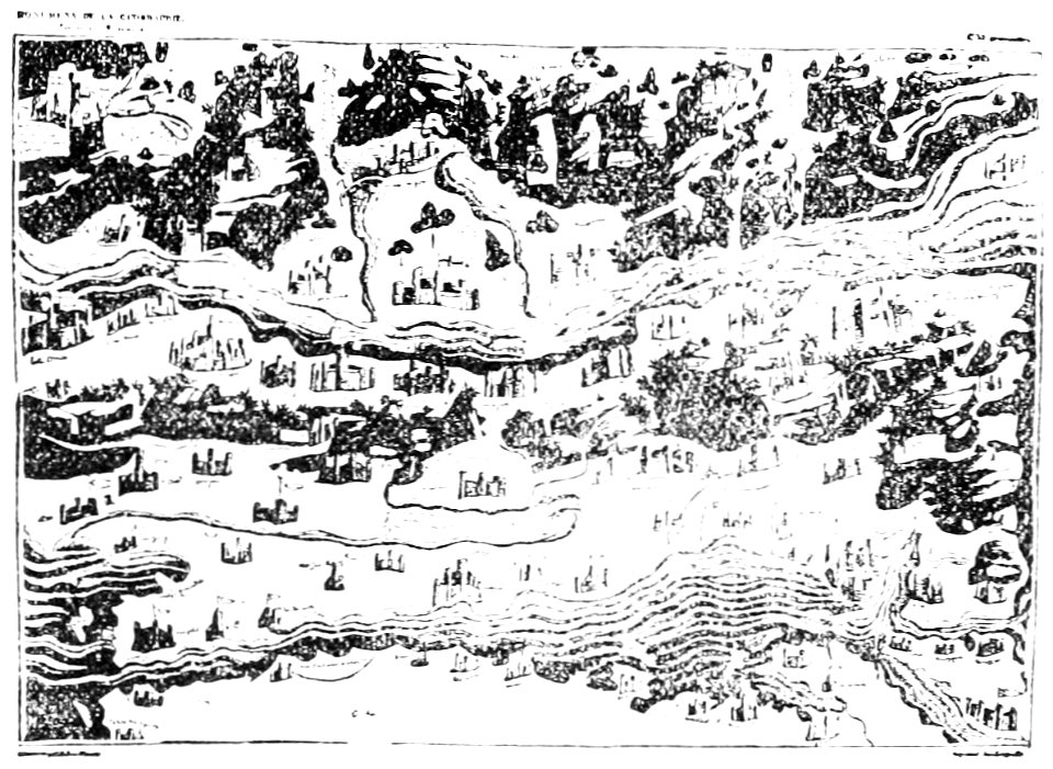
nouveau paris monumental by dufour
old maps of saxony
elector of saxony
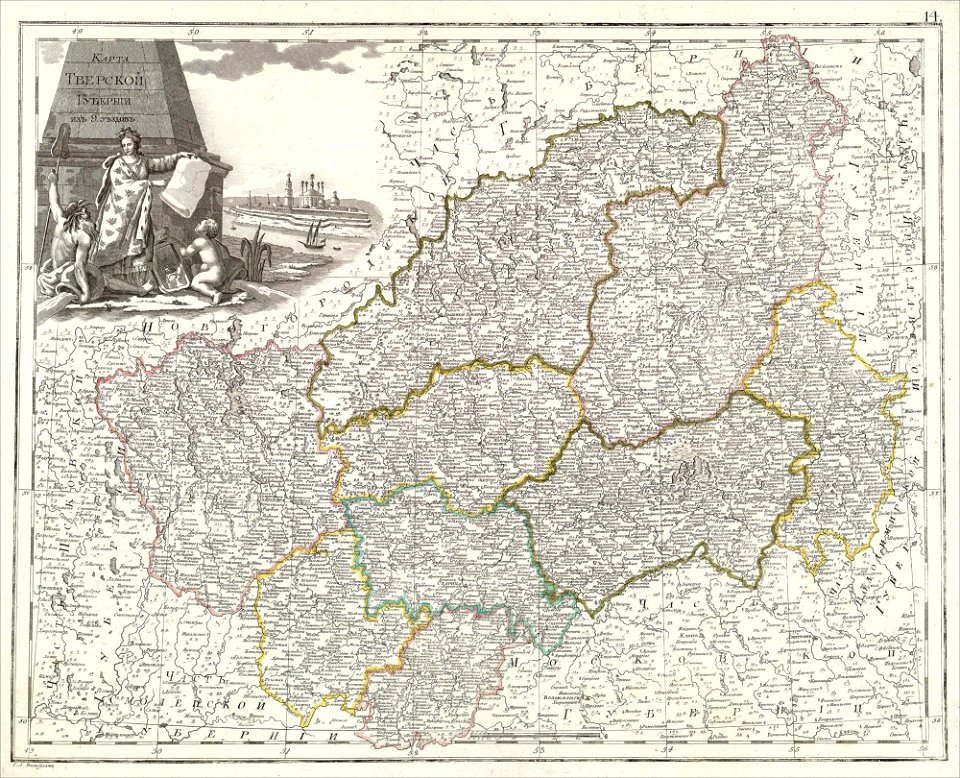
atlas of the russian empire (1800)
tver governorate
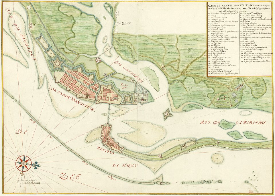
old maps of dutch brazil
1665
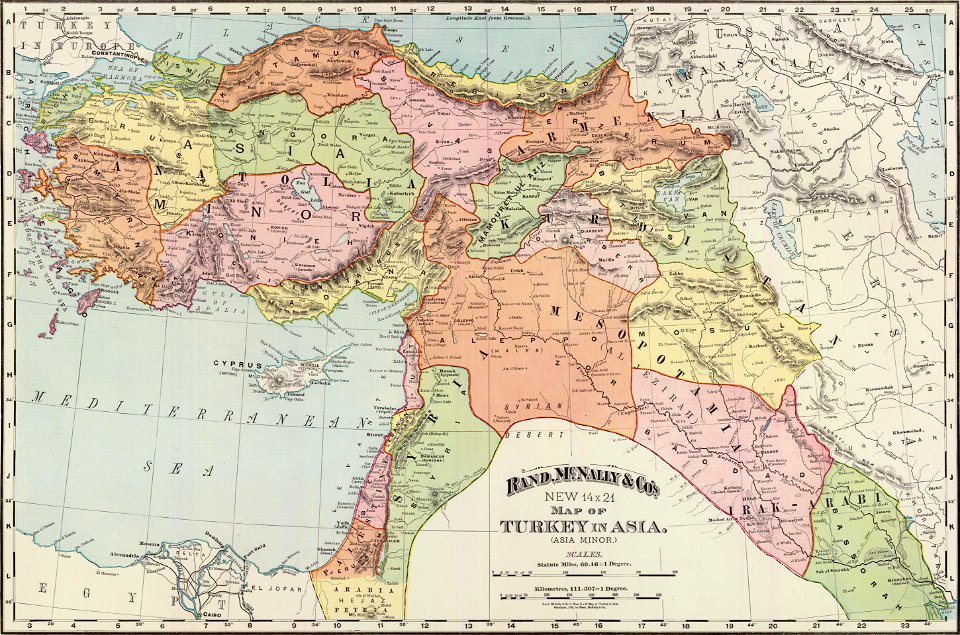
old administrative maps of the ottoman empire
rand mcnally
east river
hells gate
popular science monthly illustrations/volume 16
ancient greek maps of the world
popular science monthly illustrations/volume 16
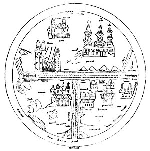
10th-century maps of the world
popular science monthly illustrations/volume 16
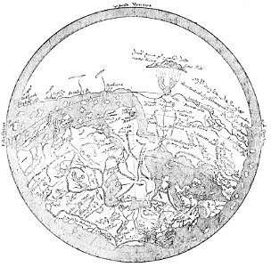
12th-century maps of the world
popular science monthly illustrations/volume 16
maps made in the 13th century
popular science monthly illustrations/volume 16
ancient greek maps of the world
popular science monthly illustrations/volume 16
11th-century maps of the world
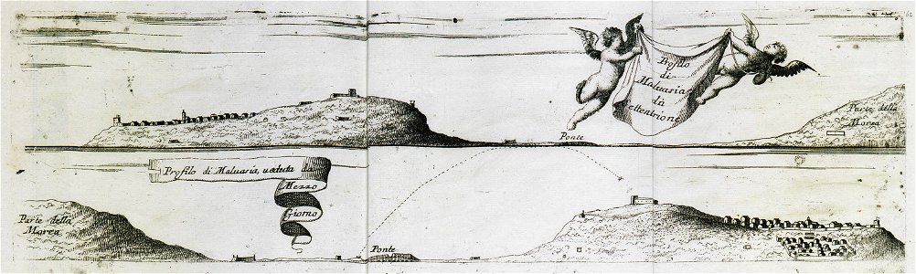
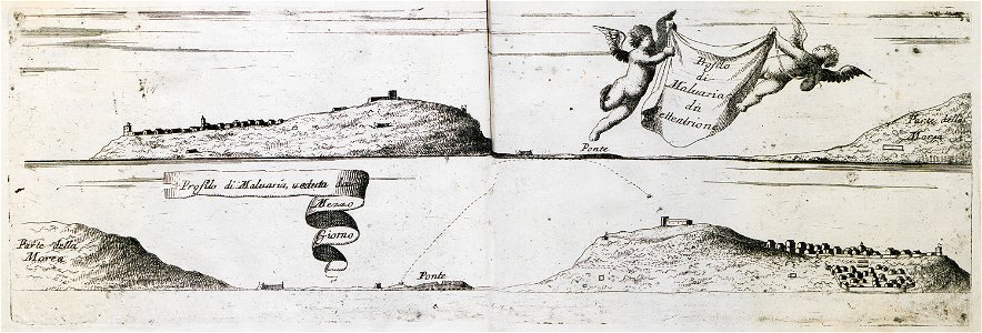
geographical illustrations by coronelli
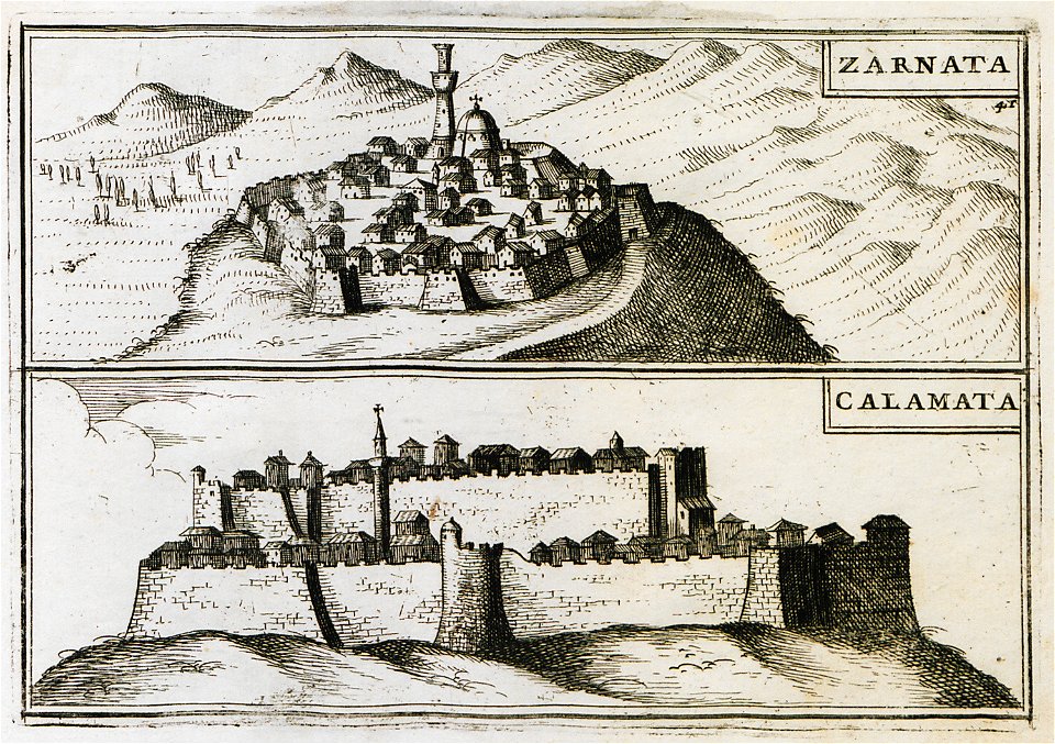
old maps of the peloponnese
geographical illustrations by coronelli
old maps of the peloponnese
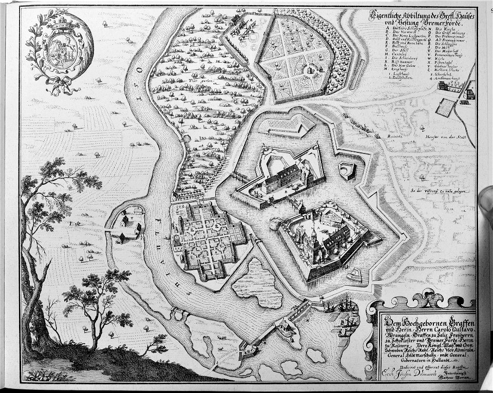
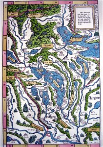
engravings of topographia saxoniae inferioris
maps of bremervörde
engravings of topographia saxoniae inferioris
topographia saxoniae inferioris (merian)
illustrations from 'robinson crusoe' by walter paget
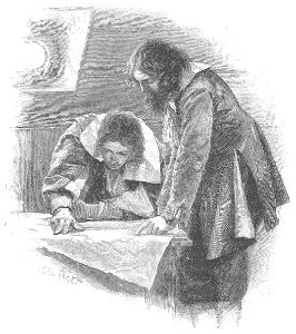
people with maps in art
old maps of saint petersburg governorate
atlas of the russian empire (1800)
leo belgicus
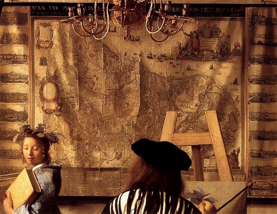
maps in art
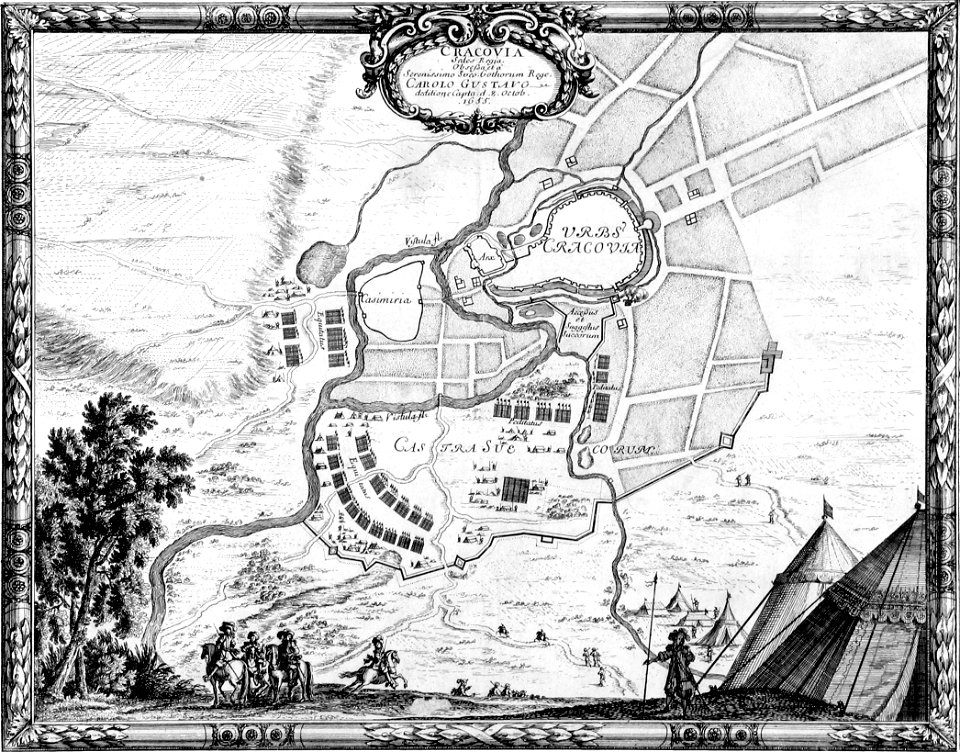
old maps of kraków
erik dahlbergh
vättern
vänern
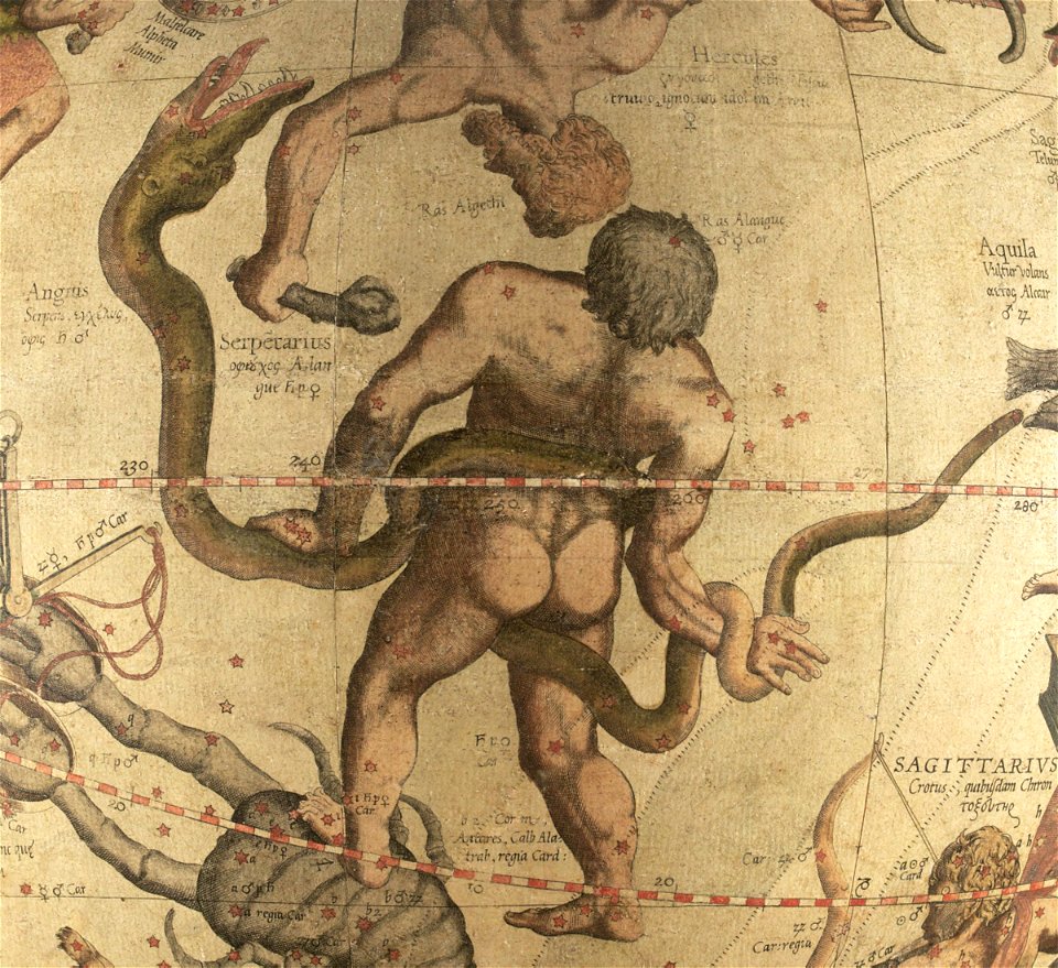
ophiuchus (constellation)
maps by gerardus mercator
geographical illustrations by coronelli
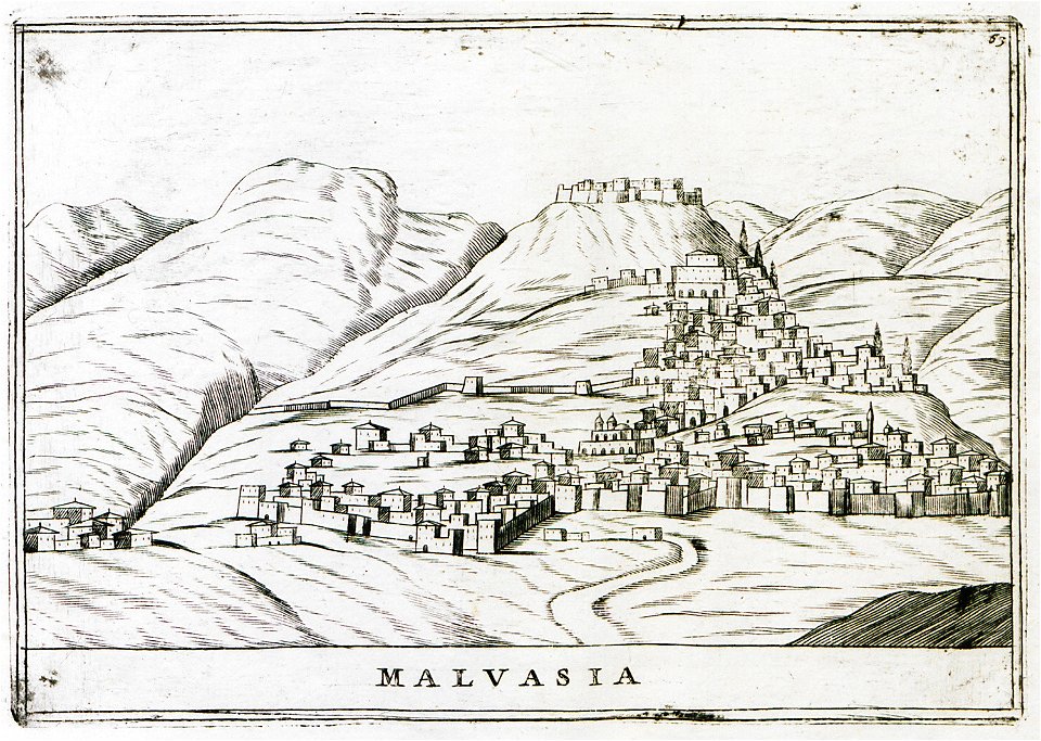
maps of monemvasia
geographical illustrations by coronelli
old maps of the peloponnese
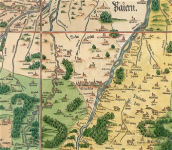
snippets of philipp apian's bairische landtafeln
old maps of boroughs in munich
zwolse diep (channel)
maps of the zuiderzee
maps in the national library of new zealand
artwork by charles heaphy
old maps of saint petersburg governorate
atlas of the russian empire (1792)
how i found livingstone
djvu files in french
how i found livingstone
djvu files in french
how i found livingstone
djvu files in french
collection de la bibliothèque municipale de reims
old maps of aube
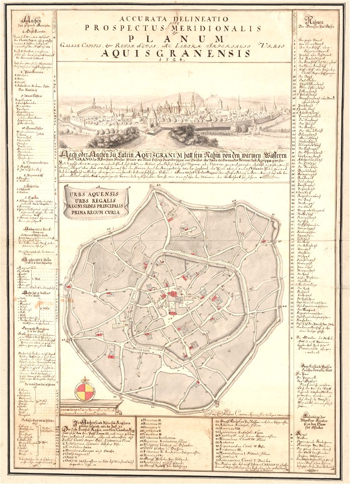
johann joseph couven
old maps of aachen
16th-century images of rome
old maps of rome
plans of castles in north rhine-westphalia
maps of rees
small atlas of the russian empire (1792)
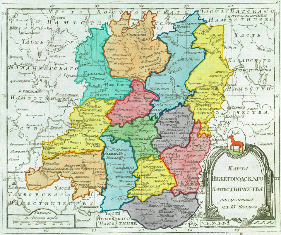
maps of nizhny novgorod governorate
small atlas of the russian empire (1796)
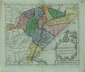
old maps of saratov governorate
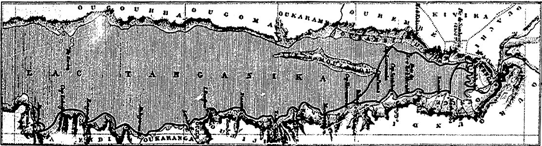
19th-century maps of tanzania
volume 1 of le tour du monde
small atlas of the russian empire (1796)
old maps of olonets governorate
volume 6 of le tour du monde
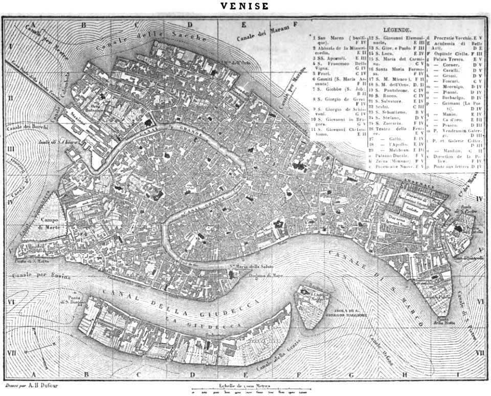
19th-century maps of venice
1758
1756
old maps of the canton of zürich
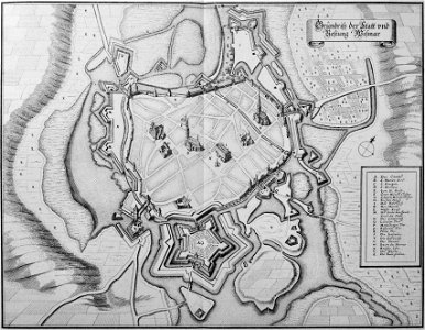
maps made in the 16th century
collections de la bibliothèque nationale et universitaire de strasbourg
old maps of territories in the upper rhenish circle
maps from the mechanical curator collection
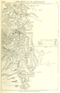
british battles on land and sea
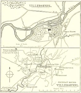
historical images of villersexel
1895 drawings
17th-century maps of maastricht
maps of the franco-dutch war
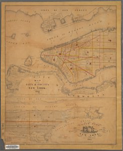
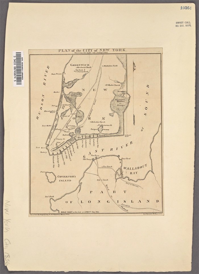
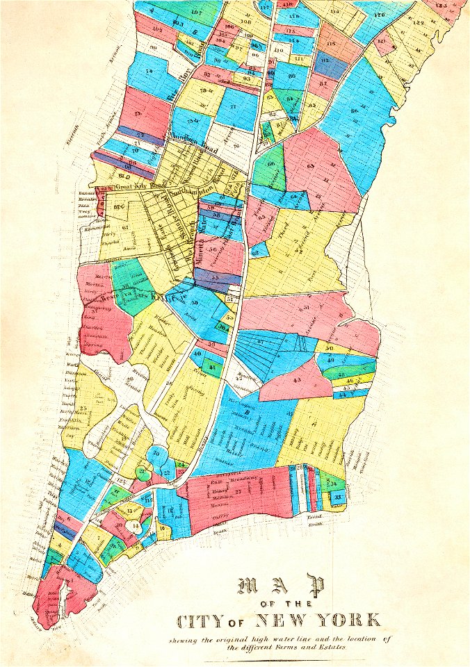
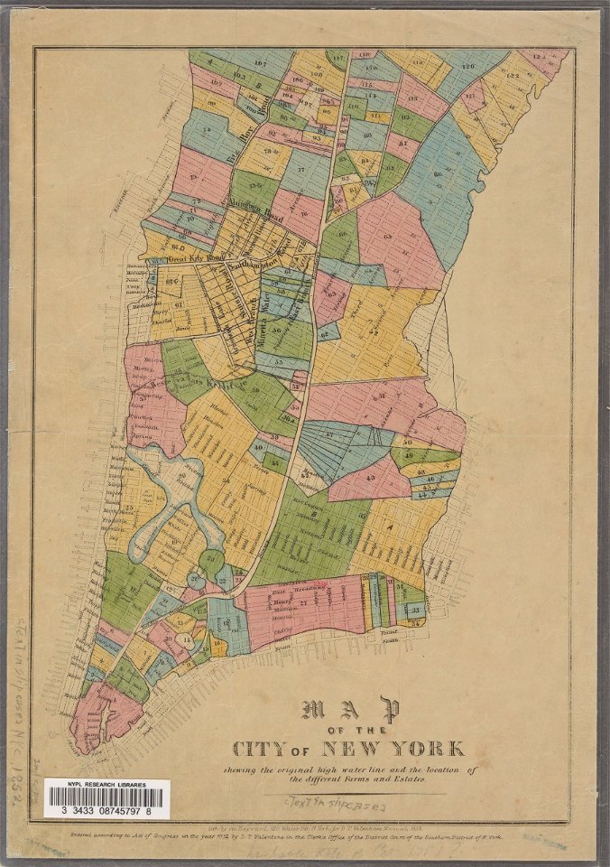
manual of the corporation of the city of new york (1861)
new york city
dutch 17th-century prints in the rijksmuseum amsterdam
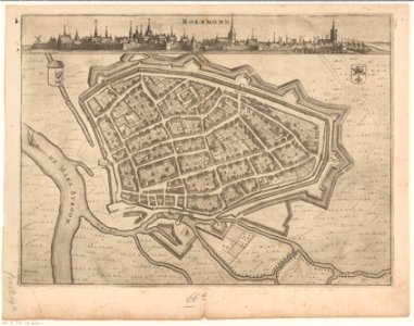
roermond in the 17th century
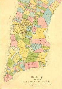
george hayward
new york city
george hayward
new york city
george hayward
new york city
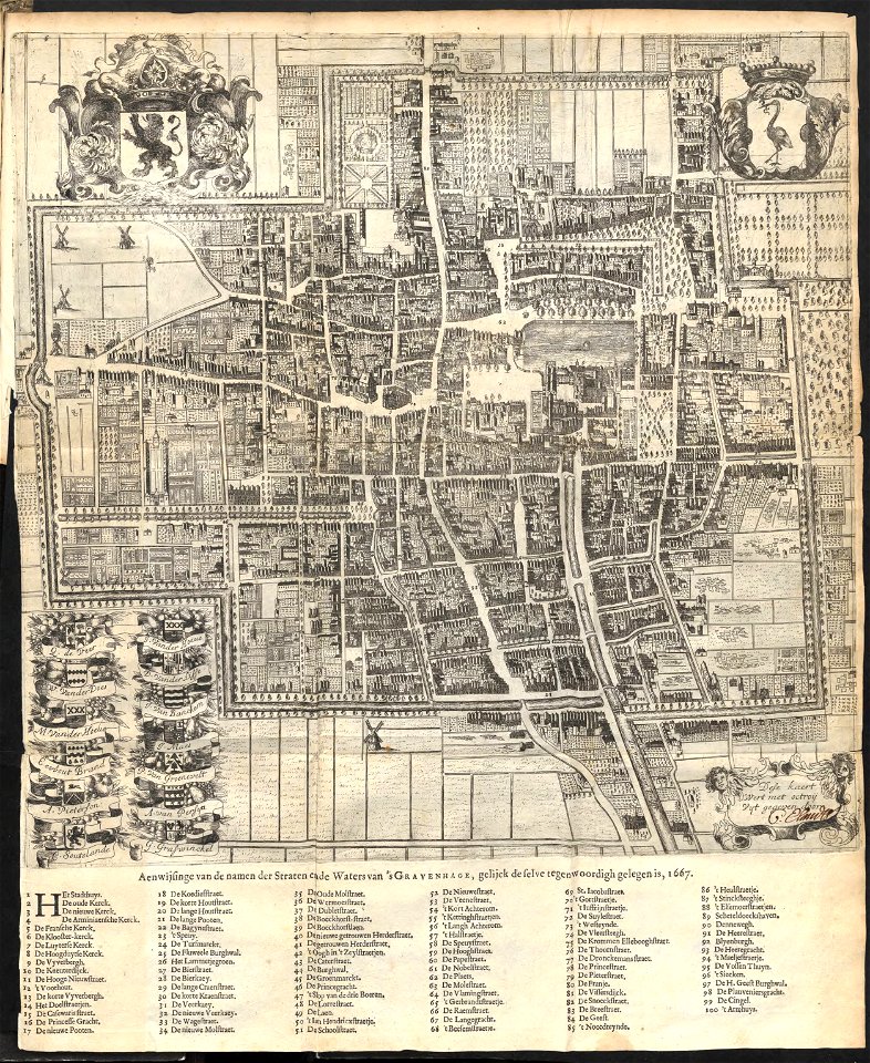
old maps of the hague
1668
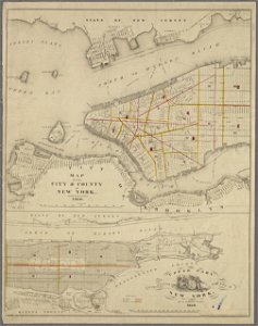
manual of the corporation of the city of new york (1856)
new york city
streets in hamburg-langenhorn
hamburger stadtentwässerung
maps from the mechanical curator collection
british battles on land and sea
castle island
bermuda
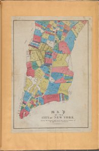
george hayward
new york city
george hayward
new york city
artworks with known accession number
artworks without wikidata item
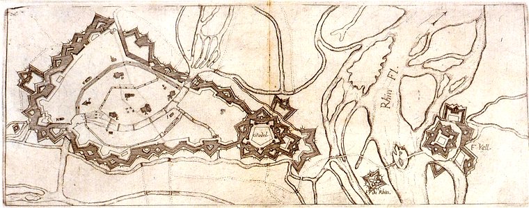
history of rhine river in germany
vauban
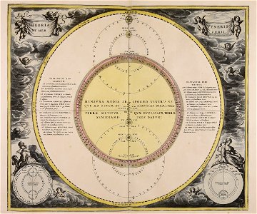
2006 in astronomy
vesta (asteroid)
maps made in the 18th century
18th-century engravings
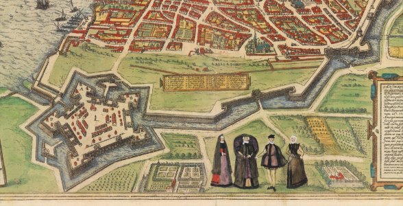
maps and topographical views by joris hoefnagel
crete under venetian rule
fonds ancely - bibliothèque municipale de toulouse - maps
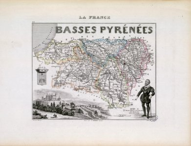
coats of arms of cities in pyrénées-atlantiques
1853
54
broad street
reading
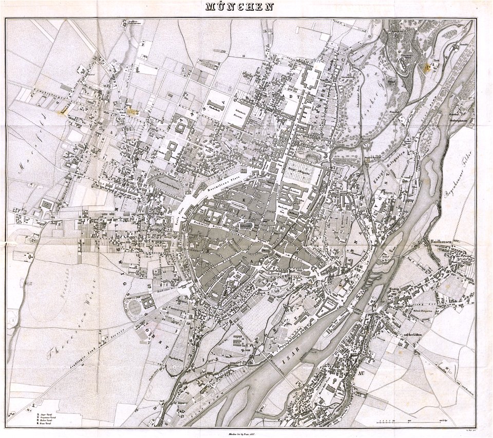
munich in the 19th century
old city maps of munich
munich in the 19th century
old city maps of munich
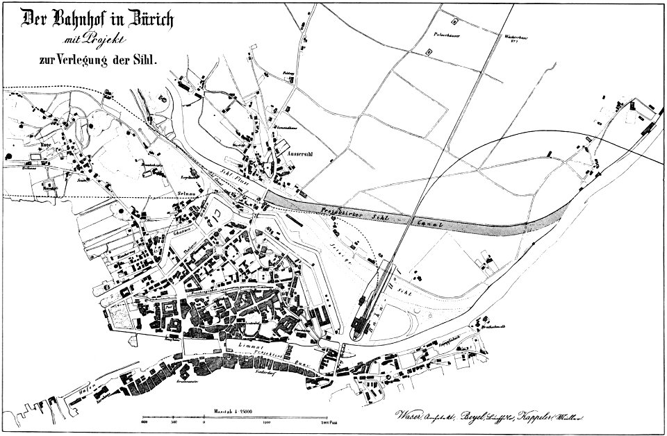
history of rail transport in switzerland
aussersihl
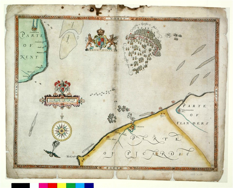
charts and maps of the royal museums greenwich
1590 maps
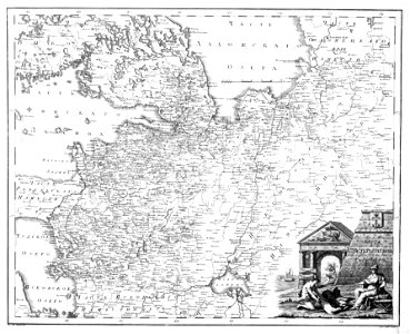
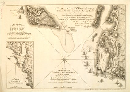
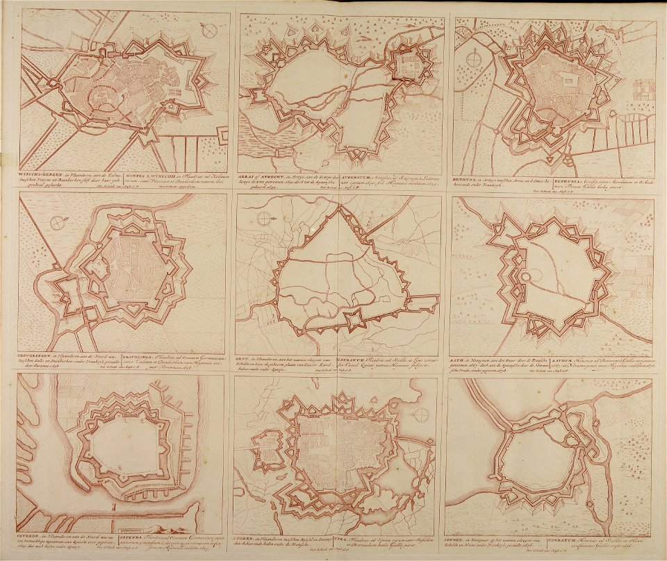
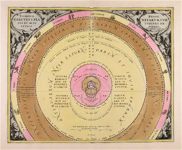
maps made in the 18th century
18th-century engravings
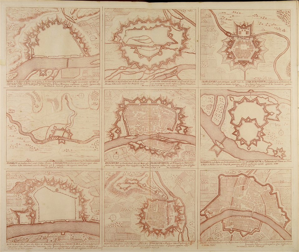
maps made in the 18th century
18th-century engravings
maps made in the 18th century
18th-century engravings
maps made in the 18th century
18th-century engravings
maps made in the 18th century
18th-century engravings
maps made in the 18th century
18th-century engravings
maps made in the 18th century
18th-century engravings
maps made in the 18th century
18th-century engravings
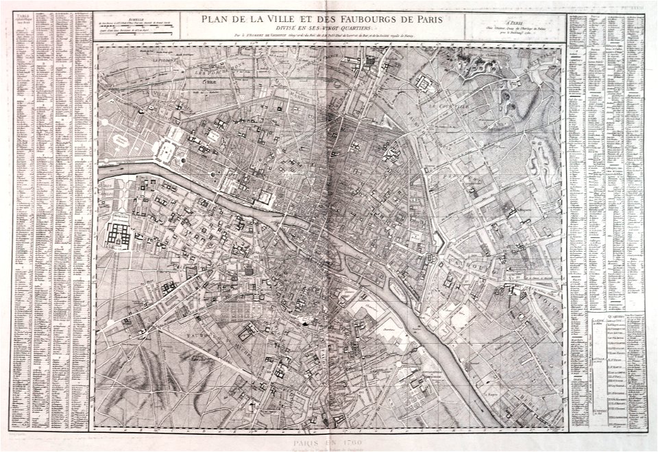
maps of paris from paris musées
1760 in paris
collections of the cabinet des estampes et des dessins
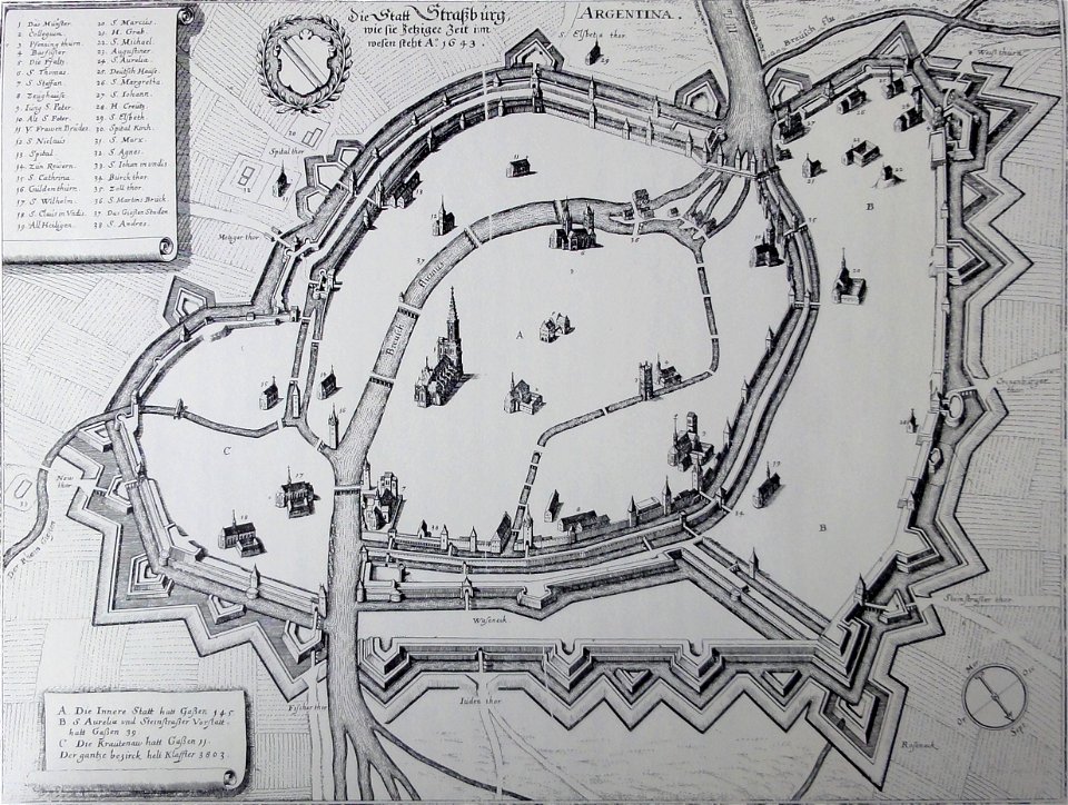
strasbourg
maps made in the 18th century
gerard valck
maps from the mechanical curator collection available to georeference
maps from the mechanical curator collection
maps made in the 18th century
gerard valck
maps in utrecht university library
indonesia
history of technology
clockworks
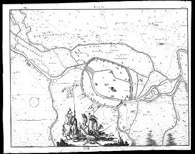
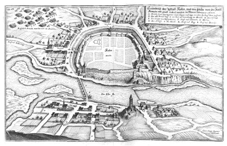
engravings of topographia bohemiae moraviae et silesiae
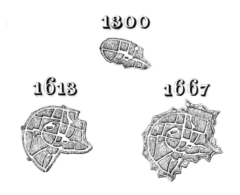
history of kolín
maps and topographical views by joris hoefnagel
historical images of brno
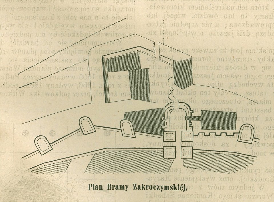
historical maps of warsaw
barbakan in warsaw
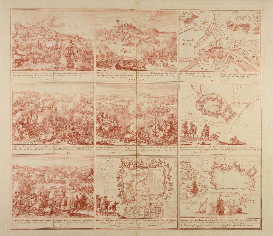
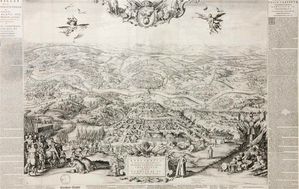
engravings of battles
willem blaeu
illustrations of cosmographia (münster)
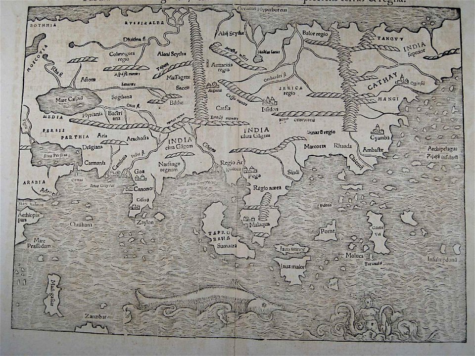
old maps of asia
rhaetiae et valesiae
merian helvetiae
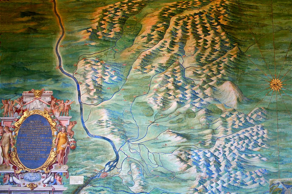
avenionensis ditio et venaisinus comitatus (galleria delle carte geografiche)
maps of comtat venaissin
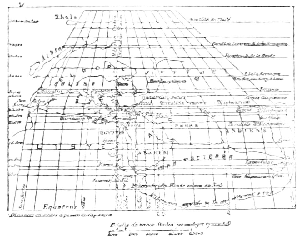
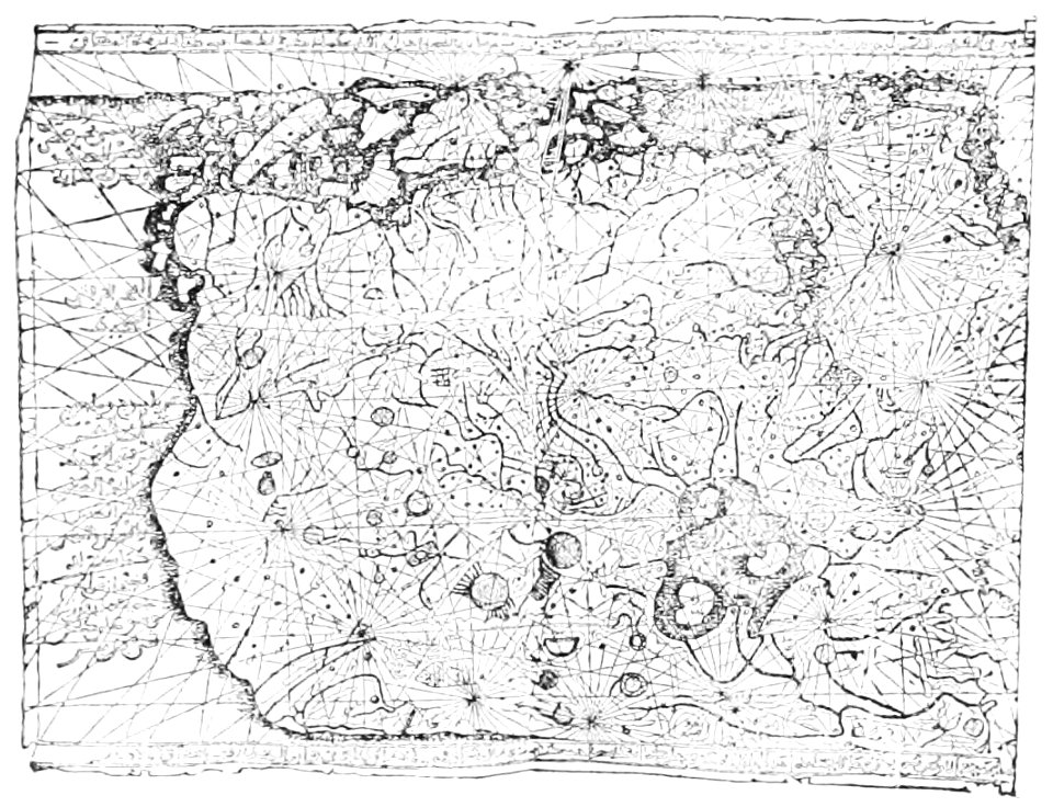
18th-century maps of the world
armillary spheres in art
illustrations from the archipelago on fire by léon benett
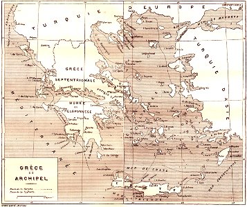
old maps of greece
kurtze beschreibung von republick venedig
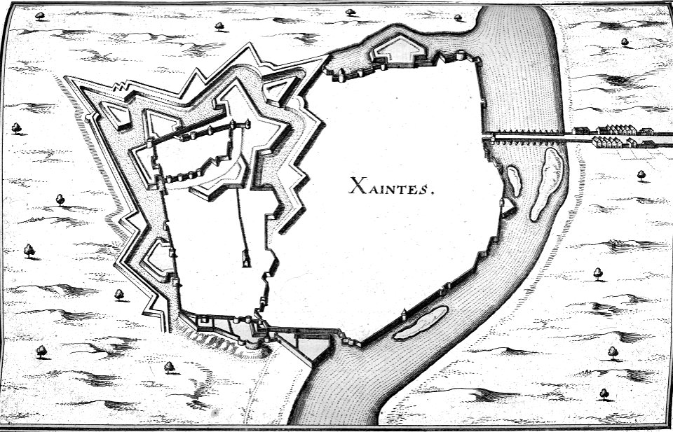
17th-century engravings of towns
bibliothèque municipale de reims
rès. g 153
geographical illustrations by coronelli
old maps of the peloponnese
maps in the library of congress
california
geographical illustrations by coronelli
athens in the ottoman era
8301 - 8400 of 33,250
Next page
/ 333